|
تضامنًا مع حق الشعب الفلسطيني |
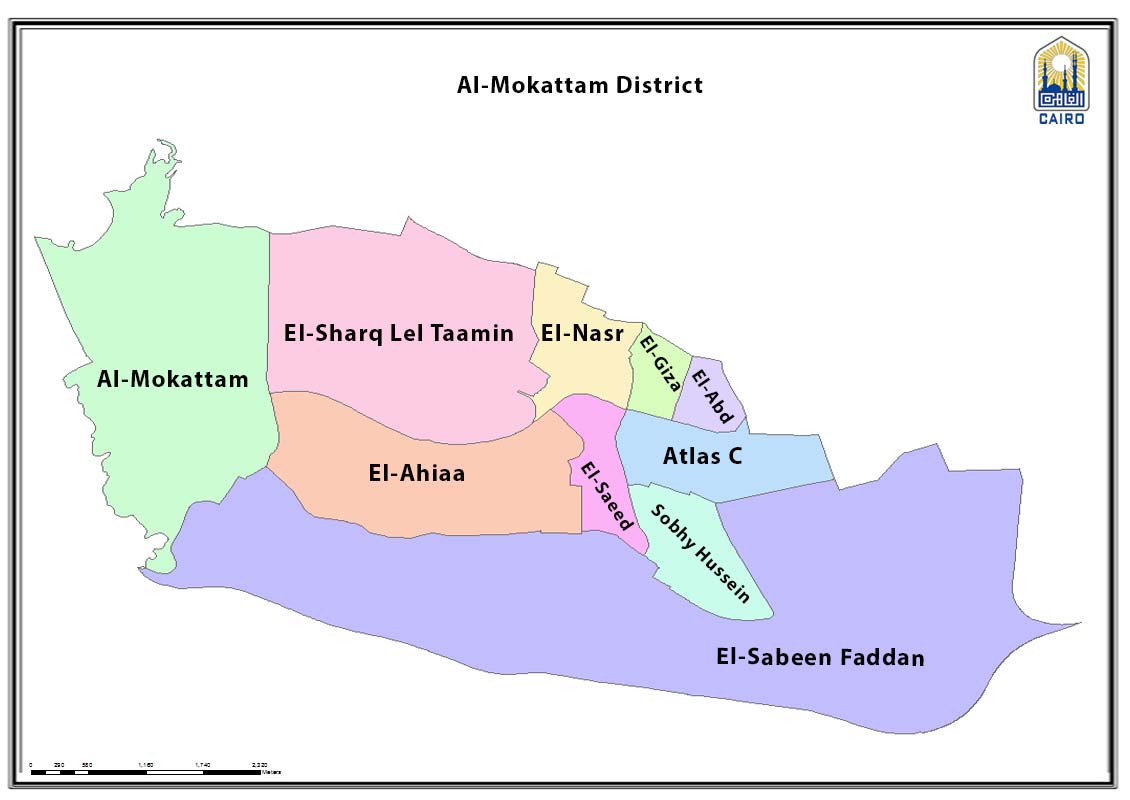
ملف:Mokattam district map, Cairo.jpg
اذهب إلى التنقل
اذهب إلى البحث
حجم هذه المعاينة: 800 × 566 بكسل. الأبعاد الأخرى: 320 × 227 بكسل | 640 × 453 بكسل | 1٬024 × 725 بكسل | 1٬130 × 800 بكسل.
الملف الأصلي (1٬130 × 800 بكسل حجم الملف: 88 كيلوبايت، نوع MIME: image/jpeg)
| هذا ملف من ويكيميديا كومنز. معلومات من صفحة وصفه مبينة في الأسفل. كومنز مستودع ملفات ميديا ذو رخصة حرة. |
ملخص
| الوصف |
English: Diatrixt map showing shiakha subdivisions |
| التاريخ | |
| المصدر | http://www.cairo.gov.eg/en/Maps/Pages/Hay_Map.aspx?ID=17 |
| المؤلف | Cairo Governorate |
ترخيص
| This work is not an object of copyright in Egypt because it is an official document. Regardless of their source or target language, all official documents are ineligible for protection in Egypt, including laws, regulations, resolutions and decisions, international conventions, court decisions, award of arbitrators and decisions of administrative committees having judicial competence. (Article 141 of Intellectual Property Law 82 of 2002) | 
|
تاريخ الملف
اضغط على زمن/تاريخ لرؤية الملف كما بدا في هذا الزمن.
| زمن/تاريخ | صورة مصغرة | الأبعاد | مستخدم | تعليق | |
|---|---|---|---|---|---|
| حالي | 01:28، 17 مارس 2023 | | 1٬130 × 800 (88 كيلوبايت) | commonswiki>Ypedia1 | Uploaded a work by Cairo Governorate from http://www.cairo.gov.eg/en/Maps/Pages/Hay_Map.aspx?ID=17 with UploadWizard |
استخدام الملف
ال1 ملف التالي مكررات لهذا الملف (المزيد من التفاصيل):
- ملف:Mokattam district map, Cairo.jpg من ويكيميديا كومنز
الصفحة التالية تستخدم هذا الملف: