|
تضامنًا مع حق الشعب الفلسطيني |
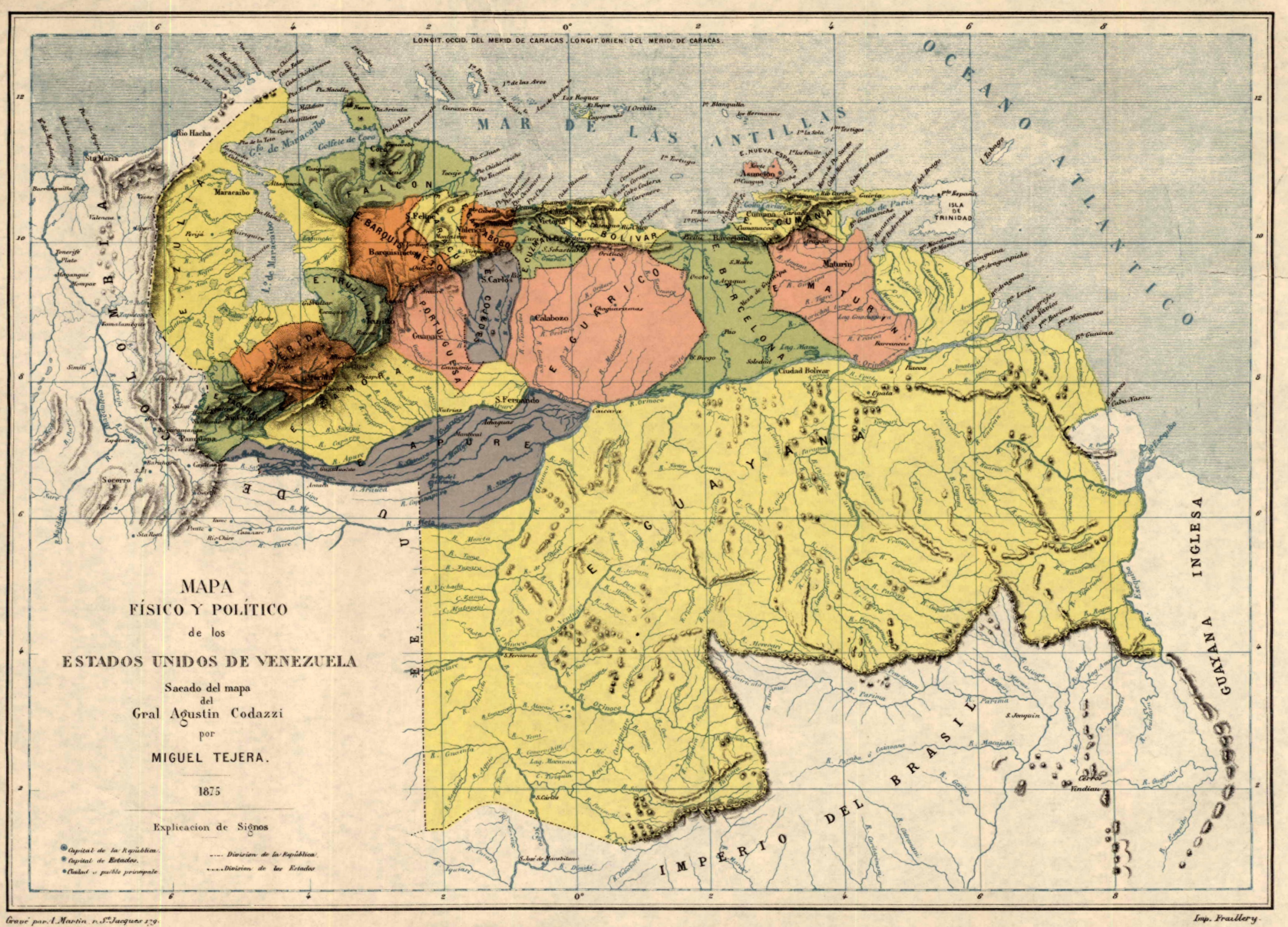
ملف:Mapa de Venezuela (1875).jpg
اذهب إلى التنقل
اذهب إلى البحث
حجم هذه المعاينة: 800 × 576 بكسل. الأبعاد الأخرى: 320 × 230 بكسل | 640 × 461 بكسل | 1٬024 × 737 بكسل | 1٬280 × 921 بكسل | 2٬560 × 1٬842 بكسل | 3٬474 × 2٬500 بكسل.
الملف الأصلي (3٬474 × 2٬500 بكسل حجم الملف: 2٫48 ميجابايت، نوع MIME: image/jpeg)
| هذا ملف من ويكيميديا كومنز. معلومات من صفحة وصفه مبينة في الأسفل. كومنز مستودع ملفات ميديا ذو رخصة حرة. |
.jpg)
ملخص
| الوصف |
Español: Mapa físico y político de los Estados Unidos de Venezuela |
| التاريخ | |
| المصدر | Walter Ortiz: EEUU y Gran Bretaña buscan promover una guerra tras el diferendo con Guyana |
| المؤلف | Miguel Tejera |
ترخيص
This work was first published in Venezuela and is now in the public domain because its copyright protection has expired in Venezuela by virtue of the “Venezuelan Law on Copyright of August 14th, 1993, Art. 25, 26 and 38” (details) because the work meets one of the following criteria:
Note to the uploader: Please provide the authorship and publication details.
|

|
تاريخ الملف
اضغط على زمن/تاريخ لرؤية الملف كما بدا في هذا الزمن.
| زمن/تاريخ | صورة مصغرة | الأبعاد | مستخدم | تعليق | |
|---|---|---|---|---|---|
| حالي | 21:40، 17 فبراير 2015 | | 3٬474 × 2٬500 (2٫48 ميجابايت) | commonswiki>Milenioscuro | User created page with UploadWizard |
استخدام الملف
ال1 ملف التالي مكررات لهذا الملف (المزيد من التفاصيل):
.jpg)
- ملف:Mapa de Venezuela (1875).jpg من ويكيميديا كومنز
الصفحة التالية تستخدم هذا الملف:
.jpg)