|
تضامنًا مع حق الشعب الفلسطيني |
ملف:Map of CSA 4.png
الملف الأصلي (1٬200 × 609 بكسل حجم الملف: 421 كيلوبايت، نوع MIME: image/png)
| هذا ملف من ويكيميديا كومنز. معلومات من صفحة وصفه مبينة في الأسفل. كومنز مستودع ملفات ميديا ذو رخصة حرة. |

|
هذه historical map الصورة / الصورتان باستعمال رسومات متجهية ملفات رسوميات شعاعية.
It is recommended to name the SVG file "Map of CSA 4.svg" - then the template Vector version available (or Vva) does not need the new image name parameter.
|
ملخص
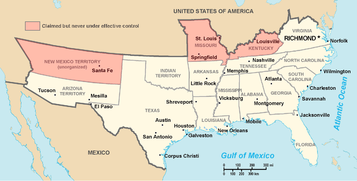
Historic Southern United States. The Confederate States have historically been regarded as forming "the South". States shown in light red are considered "border states", and gave varying degrees of support to the Southern cause although they remained in the Union. (This image depicts the original, trans-Allegheny borders of Virginia, and so does not show West Virginia separately. See the images above for post-1863 Virginia and West Virginia borders.) Although much of Indian Territory was aligned with the Confederacy, it had not yet been introduced into the Union as the state of Oklahoma. Drawn by Nicholas F Source en:wikipedia
ترخيص
| |
وُضِعت هذه الصُّورة في النِّطاق العامّ مِن قبل مُؤَلِّفها، Nicholas F في مشروع Wikimedia Commons. ويسري هذا في جميع أَنحاء العالم. إِذا لم يكن النِّطاق العام مُمكِناً مِن النَّاحية القانونيَّة:
|
تاريخ الملف
اضغط على زمن/تاريخ لرؤية الملف كما بدا في هذا الزمن.
| زمن/تاريخ | صورة مصغرة | الأبعاد | مستخدم | تعليق | |
|---|---|---|---|---|---|
| حالي | 03:22، 18 مارس 2006 | | 1٬200 × 609 (421 كيلوبايت) | commonswiki>Fabrizio Fiorita~commonswiki | Drawn by Nicholas F Source en:wikipedia |
استخدام الملف
ال1 ملف التالي مكررات لهذا الملف (المزيد من التفاصيل):
- ملف:Map of CSA 4.png من ويكيميديا كومنز
الصفحة التالية تستخدم هذا الملف: